Maharastra presents an interesting range of landforms drained by numerous rivers and their tributaries. The Narmada River, flowing into the Arabian Sea through a rift valley, marks a part of the northern boundary of the State. The other rift valley, of the Tapti River, also flowing into the Arabian Sea, marks the other part of the northern boundary. These two river valleys are separated by a horst known as the Satpura Range.
Following is the detail analysis of the Rivers of Maharastra:-
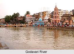
Godavari River: The Godavari is the largest Peninsular river system. It is also called the Dakshin Ganga. It rises in the Nasik district of Maharashtra and discharges its water into the Bay of Bengal. Its tributaries run through the states of Maharashtra, Madhya Pradesh, Chhattisgarh, Odisha and Andhra Pradesh. It is 1,465 km long with a catchment area spreading over 3.13 lakh sq. km 49 per cent of this, lies in Maharashtra, 20 per cent in Madhya Pradesh and Chhattisgarh, and the rest in Andhra Pradesh. The Penganga, the Indravati, the Pranhita, and the Manjra are its principal tributaries. The Godavari is subjected to heavy floods in its lower reaches to the south of Polavaram, where it forms a picturesque gorge. It is navigable only in the deltaic stretch. The river after Rajamundri splits into several branches forming a large delta.
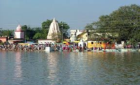
Godavari Basin extends over an area of 312,812 km in five states, which is nearly 9.5% of the total geographical area of the country. ‘Vishnupuri Prakalp’, Asia’s largest Lift irrigation project is constructed on the river just 5 km away from Nanded city.the river is considered to be a holy river and is taken to be place of pilgrimage.
The main tributaries of the Godavari are:
- Indravati River
- Wardha – Wainganga Rivers
- Manjira River
- KInnerasani River
- Pranahita River
- Parvara River
- Purna River
- Penganga River
- Kolab River
- Sabari and Sileru Rivers

Krishna River:The krishna river is one of the longest rivers in the country the second largest east-flowing Peninsular river. This River rises from a place with an elevation of 1337m north of Mahabaleshwar. The Ghataprabha, the Malaprabha, the Bhima, the Tungabhadra and the Musik are the principal tributaries joining Krishna. Krishna Basin extends over in three states with an area of 258,948 km2, which is nearly 8% of the total geographical area of the country. it flows through the city of Sangli.
Krishna Basin extends over an area of 258,948 km2, which is nearly 8% of total geographical area of the country. The krishna basin lies in the states of Karnataka (113,271 km2/ 44 per cent), Andhra Pradesh (76,252 km2/29 per cent) and Maharashtra (69,425 km2/ 27 per cent). Krishna River has a catchments area of 25.9 m.ha.
Most part of this basin comprises rolling and undulating country except the western border, which is formed by an unbroken line of ranges of the Western Ghats. The important soil types found in the basin are black soils, red soils, laterite and lateritic soils, alluvium, mixed soils, red and black soils and saline and alkaline soils.
An average annual surface water potential of 78.1 km3 has been assessed in this basin. Out of this, 58.0 km3 is utilisable water. Culturable area in the basin is about 20.3 Million ha, which is 10.4% of the total culturable area of the country. Present use of surface water in the basin is 50.0 km3.
Live storage capacity in the basin has increased significantly since independence. From just about 3.2 km3 in the pre-plan period, the total live storage capacity of the completed projects has increased to 34.5 km3. In addition, a substantial storage quantity of over 4.9 km3 would be created on completion of projects under construction. An additional storage to the tune of over 0.1 km3 would become available on execution of projects under consideration. The hydropower potential of the basin has been assessed as 2997 MW at 60% load factor.
Tapi River: Tapi River rises from a place with an elevation of 752m near Multai in the Betul district of Madhya Pradesh. It flows for about 724 km before out falling into the Arabian Sea through the Gulf of Cambay. The Purna, the Girna, the Panjhra, the Vaghur, the Bori and the Aner are the principal tributaries of Tapi. Tapi Basin extends in three states with over an area of 65,145 km2, which is nearly 2.0% of total geographical area of the country. The Tapi river is entere at sea near Surat.And the Average annual surface water potential is 18 cubic km. and drains an area of 30,000 sq. m.
The basin consists plain areas, which are broad and fertile, suitable for cultivation. The principal soils found in the basin are black soils, alluvial clays with a layer of black soil above.
. Out of this 14.5 km3 is utilisable water. Cultivable area in the basin is about 4.3 Million ha, which is 2.2% of the total cultivable area of the country.
Tapti River
Like Narmada, Tapti also terminates into the Arabian Sea. It has its origin in Madhya Pradesh near a place called Pachmari. Tapti smaller than Narmada, Tapti is a rich source of alluvium and produces good agricultural soil.

Wardha:
Wardha is the tributary of River Godavari. It originates from the Mutai plateau of the Satpuda range and flows along the entire northern and western border of the Wardha district.
Maharashtra Coastal Rivers
Vashishti River
| Name of River | Vashishti River |
| Location | (Maharashtra), India |
| Origin | Western part of the Western Ghats |
Vashisthi River is regarded as largest rivers .It would be staring from western ghat and river would be flowing through westward and then it would be reaching into Arabian Sea and that is at Dabhol. There are numerous tributaries and that would be joining the river and you can check out some of the other places as well. There are numerous riverine islands that could be seen near this river and town chiplun is also present on river banks.
Savitri River
| Name of River | Savitri River |
| Location | India (Maharashtra) |
| Origin | Mahabaleshwar in Maharashtra state |
This is one of the five rivers and it would be originating through Mahabaleshwar and it is present in Maharashtra state. It would be flowing from Raigad district and then it would be meeting in Arabian Sea and that is at the Harehareshwar. It would be passing through Mangaon, Poladpur, Shrivardhan taluks and Mahad. There are Tample of Shiva temples and all of them are located on Savitri river banks. It is approximately 100 ms and it is present between Ratnagiri and Raigad.
Patalganga River
| Name of River | Patalganga River |
| Location | (Maharashtra) India |
| Origin | Sahyadri scarp, Khandala portion |
| Length | 55 kms |
Ulhas River
| Name of River | Ulhas River |
| Location | India (Maharashtra) |
| Origin | Western Ghats Range |
Mithi River or Mahim River
| Name of River | Mahim River or Mithi River |
| Location | (Maharashtra), India |
| Origin | Overflow of Powai Lake and Vihar Lake |
| Length | 15 kms |
| Depth | 12 m |
Oshiwara River
| Name of River | Oshiwara River |
| Location | (Maharashtra), India |
| Origin | Aarey Milk Colony |
| Length | 7 km (4 mi) |
Dahisar River
| Name of River | Dahisar River |
| Location | (Maharashtra), India |
| Origin | Mumbai Suburban District, Sanjay Gandhi National Park, |
| Length | 12 km (7 mi) |
Vaitarna River
| Name of River | Vaitarna River |
| Location | (Maharashtra), India |
| Origin | Nashik district, Tryambak hills |
| Length | 154 km |
MPSC Notes brings Prelims and Mains programs for MPSC Prelims and MPSC Mains Exam preparation. Various Programs initiated by MPSC Notes are as follows:-
- MPSC Mains Tests and Notes Program
- MPSC Prelims Exam 2020- Test Series and Notes Program
- MPSC Prelims and Mains Tests Series and Notes Program
- MPSC Detailed Complete Prelims Notes